Historic England, English Heritage, Politecnico di Milano, Salamanca University, Stanislaw
Staszic Scientific Association
September 2015 to April 2018
Multi-Stakeholder with UK heritage sector charities and university across UK and Europe (Italy, Poland and Spain)
Diachronic landscape change studies are fundamental for documenting, maintaining and safeguarding all forms of cultural heritage in a sustainable manner.
Utilising time-varying 3D products, from landscape to architectural scale, to envisage and
analyse lost scenarios or visualize changes due to anthropic activities or intervention,
pollution, wars, earthquakes or other natural hazards.
Facilitated through Joint Programming Initiative in
Cultural Heritage (JPI-CH): http://www.jpi-culturalheritage.eu with UK
funding from UK Arts and Humanities Research Council
(AHRC, award number AH/N504440/1).
The collaboration enabled generation of 4D (3D+time) digital
models of cultural heritage (CH) sites, and development of methodology for future monitoring of
heritage evolution (structures and landscapes) as a means of safeguarding. The methodology to
collect actual and historic heterogeneous datasets such as survey data, photographs, 3D
non-contact data (as those from laser scanning or photogrammetry), and semantic data among others
and data fusion to facilitate CH 4D analysis was implemented at rural and urban landscape scales
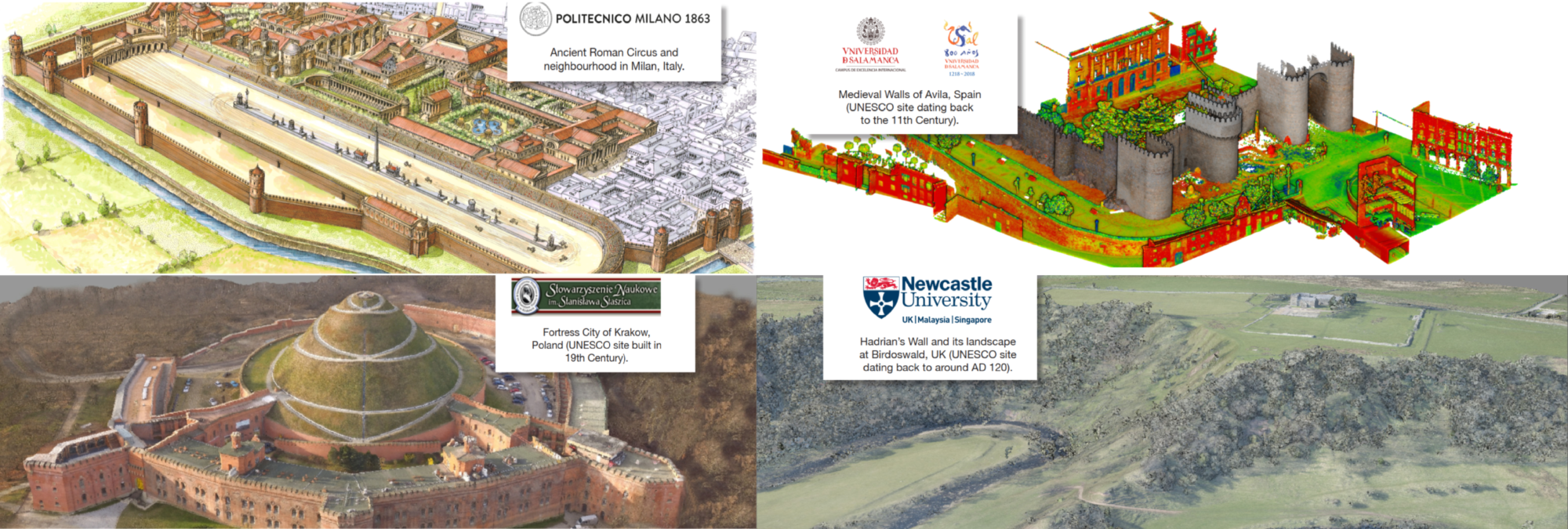
with four case studies in Europe (Figure 1).
Wall sites, such as Birdoswald and Beckfoot, have seen dramatic change as a result of natural processes in the last couple of decades, at others such as Corbridge, the transformation is less obvious, but nonetheless profoundly significant. Modelling 4D change allows us to quantify and communicate the rate and pattern of change, but it also helps advance research into such sites more generally (Figure 2).
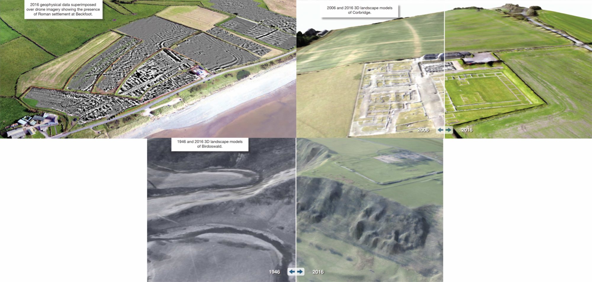
CHT2 of the UK case study has already left several important legacies on Hadrian’s Wall, its methodology is already being implemented and contributed to the rationale for a recent IAPETUS-funded PhD on the modelling of environmental change and its impact on Hadrian’s Wall. Furthermore, it has also enriched the data of ongoing field projects at both Beckfoot and Corbridge. To this must be added the fact that CHT2 data offers a vital indication of just how at risk our ‘at risk’ sites really are.
The 4D approach of CHT2 provided the potential to help us critically appraise retro-projections of landscape change around the Hadrian’s Wall. The capacity to map recent landscape change with vastly higher resolution opens up the possibility of adding a further form of controlled modelling of longer-term trajectories to be set alongside other sources of environmental data for ancient sites.
More about the CHT2 Project: http://cht2-project.eu/
Cultural Heritage through Time- Exhibition video: https://www.youtube.com/
watch?v=nDlpEl-8J2Y&feature=youtu.be
